
Work a Norton Shores Street Address
A street-by-street search works best when it follows the address rather than a name. Start with the normal street form and look for the current parcel record. Then use the same location in the map viewer, move from the parcel to the legal description, and only then look for historical household evidence. This sequence avoids a common error: calling an owner or an out-of-city mailing addressee a current occupant. It also keeps a current tax record from being blended with a much older directory entry.
For a reliable record trail, retain the address as the source displayed it, plus a normalized number, direction, street name, suffix, unit, municipality, ZIP, parcel number, source date, and the role shown for a person or entity. A direct address match is stronger than a name match. A record that merely touches the same street is not proof of a household connection.
- Run the ordinary address through the county property system and confirm the street number, direction, and parcel result.
- Use the address or number range in BS&A, then try its advanced address option if an exact form misses.
- Open the parcel in the GIS viewer and compare the property address, parcel geometry, and nearby polygons.
- Use the legal description and known parties in the recorder index to assemble a deed chain, checking document images when available.
- For an older household question, consult the local historical directory and newspaper collections with the date kept alongside the address.
Note: A street name is a starting key, not a complete resident list, because each record system uses a different date and purpose.
Search a Norton Shores Street Range
Muskegon County BS&A Online is the practical first stop for a current Norton Shores address. Its available record areas include All Records, Assessing, Delinquent Tax, Tax, and Utility Billing. The observed search choices are Address, Name, Parcel Number, and Utility Billing Location ID. For street work, select the address route rather than relying on an owner name, because ownership and occupancy are separate facts.
The address screen identifies Street Address and Street Number from/to and offers Advanced Address Search. Begin with a normal address. If the result is too narrow, use the street name with a number range, then compare each returned situs address and parcel number. The live application did not expose every advanced field during research, so no unverified filter should be assumed. Utility billing appears among the record areas, but that does not create a public household directory.
| BS&A field or route | Use for street research | Careful reading |
|---|---|---|
| Street Address | Find a normal address form | Check direction, suffix, and unit against the returned address |
| Street Number from/to | Review a segment of one street | Verify each parcel individually before drawing a conclusion |
| Advanced Address Search | Broaden a failed exact-address search | Only documented advanced control, not a claim about every field |
| Parcel Number | Return to one confirmed parcel | Keep it with the legal description and source date |
| Name | Find an ownership lead | Never treat an owner-name result as occupancy proof |
Norton Shores Street Directory Fields
The Muskegon GIS parcel layer separates several address and ownership concepts that are easy to conflate. Its schema includes a PIN, combined property address, city, state, ZIP, owner names, care-of and mailing fields, values, principal-residence exemption data, class, school district, zoning, and tax description. For a Norton Shores street directory search, the property address is the situs or physical location. A mailing field can point somewhere else.
The service supports field selection, geometry, distance, ordering, pagination, and other query controls. Those are service capabilities, not a promise that the consumer-facing viewer shows a radius button or every field. Map adjacency is geographic only. Parcels that touch, or sit near, one another do not establish a social relationship between their owners or occupants.
The published parcel-field reference documents the address, ownership, and land attributes available in the county service.
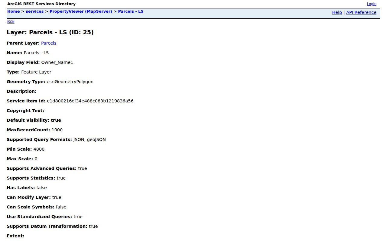
Use the field names to keep the Norton Shores property location, mailing details, parcel identifier, and land attributes in separate columns of a research note.
Norton Shores Street Parcel Terms
Parcel research becomes clearer once a few county land-record terms are kept distinct. The GIS viewer and property roll can supply a location and a parcel identity, while a recorded instrument uses the legal description to establish the land referenced. A plat or condominium layout may add lots, common areas, and access strips that look unfamiliar on a map.
- Parcel
- A county-tracked unit of land, usually tied to a PIN or parcel number and a set of assessment attributes.
- Situs address
- The physical property address. It is different from an owner mailing address or care-of field.
- Plat
- A recorded map that lays out lots, blocks, streets, or common areas in a subdivision or condominium setting.
- Criss-cross directory
- A historical directory arranged by address, useful for a dated household lead rather than a current-status statement.
When a map shows a narrow strip or an unusual polygon, read the layer name and legal description before treating it as a regular street parcel. Easements and rights-of-way can appear beside private lots without being a separate home site.
Follow a Norton Shores Street Deed Trail
The Muskegon Records recorder index is an index and catalog, not a substitute for the recorded document. The county's separate Record Search information says its database portion reaches from 1859 to the present. Begin a Norton Shores street deed trail with the current parcel, legal description, and known owner. A street address alone may not work in the recorder system, so grantor and grantee names plus legal-description clues matter.
Record the instrument date, document type, grantor, grantee, recording reference, legal description, and whether an image is available. A grantor generally transfers an interest and a grantee receives it, but estates, trusts, corporations, parcel splits, and name changes can interrupt the apparent sequence. Compare lot, block, subdivision, section, township, range, or metes-and-bounds language across the documents. An older deed may not display the current PIN.
For older material, Hackley's microfilm chronology identifies a Register of Deeds index for 1838 to 1887 and records into 1928. That historical route can help when online results end, but it remains a land-history search, not a current household roster.
Note: A deed index hit is a lead until the legal description and municipality agree with the parcel being researched.
Norton Shores Street Directory Records
Address-keyed sources can be compared, but their roles should not be merged. BS&A and GIS describe parcels, assessment attributes, and owner or mailing fields. The recorder follows land instruments. City applications provide an email, mail, or in-person route but research did not locate a public result index for Norton Shores permits. The Michigan Voter Information Center requires a first name, last name, birth month and year, and ZIP, so it is not a street-browse tool. It also withholds selected voter fields and does not offer party registration.
| Address-keyed source | Keeper | What it can establish | Access and limit |
|---|---|---|---|
| Assessing and tax records | Muskegon County BS&A | Parcel, property address, owner lead, and assessment context | Online search; owner is not occupancy |
| Parcel map and schema | Muskegon County GIS | Geometry, situs, ZIP, owner and mailing fields, zoning | Viewer and service; inspect field roles separately |
| Recorded instruments | Muskegon County Register of Deeds | Land transfer trail and legal-description evidence | Online index; document image or office route may be needed |
| Building applications | City of Norton Shores | Application route for a site address | Email, mail, or in person; no public result index located |
| Historical directories and microfilm | Local library collections | Dated address or household leads | Historical coverage and access vary by collection |
A well-kept street record labels a person or entity as owner, mailing addressee, historical directory occupant, applicant, or adjacent parcel party. That simple role label prevents current and historical records from being flattened into one claim.
Norton Shores Private Street Responsibilities
The Norton Shores street FAQ distinguishes private condominium streets from public responsibilities. Private condo streets are generally maintained by their association, while the city maintains water supply. Public Works handles right-of-way concerns. A private-drive label or association maintenance rule therefore does not tell who lives in a unit, nor does it change the parcel evidence needed for an address search.
On a map, use plat, easement, and condominium layers to understand common areas, lots, access strips, and public or private street status. An association page can explain maintenance structure, but it is not a public member directory. For a street or right-of-way question, the city contact directory lists the assessing desk at 231-799-6806 and the streets contact at 231-798-2156.
The city's street-responsibility information is the source behind this local distinction.
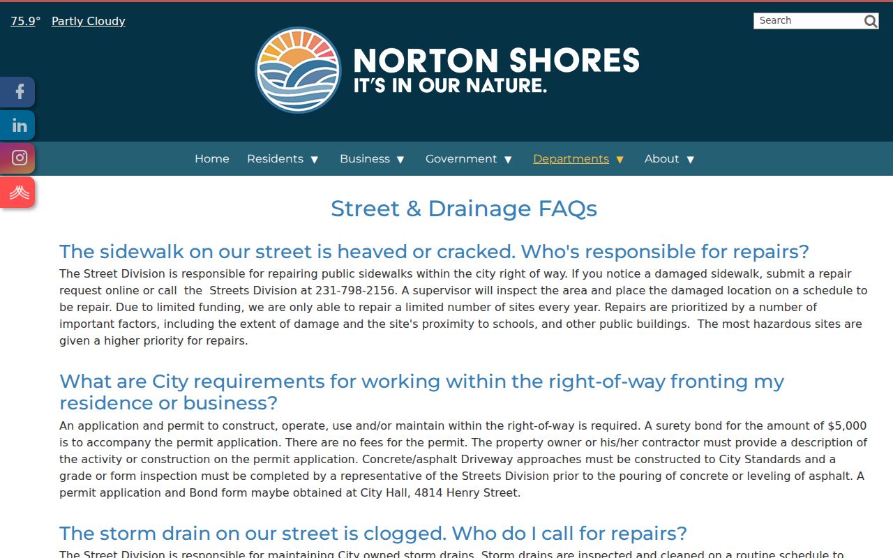
This distinction helps a Norton Shores street search describe a road correctly without turning an association-maintained drive into a claim about household membership.
Norton Shores Street Names Before 1968
Norton Shores adopted its city charter in 1968. Earlier sources can use Norton Township or a Muskegon-area label instead. Preserve the source's original place name beside the current location rather than silently converting it. The change in civic label does not prove a street changed, and it does not redraw a historical address onto a modern boundary.
The Muskegon County Genealogical Society lists 1887 to 1889 street-name-change index headings and a 1925 renumbering lead. Research did not expose the underlying lists or show that a particular Norton Township road was affected. Treat them as a reason to test spelling, numbering, and date-specific maps after a failed modern address search, not as proof of a local renumbering.
Hackley Public Library's Torrent House is the local route for historical questions, with microfilm, directories, maps, and county-record material. Its staff ask visitors to bring specific questions, which is especially useful when a street form has more than one historical possibility.
Norton Shores Street Tax Route
Property-tax information is a payment and service route, not an owner search. The Norton Shores property-tax FAQ says summer bills begin July 1 and winter bills begin December 1. Online payment needs no account. Phone payment requires the 12-digit parcel ID. Card payments add 2.8 percent, while ACH carries no fee. Mail, a 24-hour drop box, and the Monday through Friday counter are also listed.
Use a parcel ID only after it has been matched to the address in an official property record. Payment timing, a payment method, or a bill route does not establish who resides at a property. For assessment questions tied to a Norton Shores street, the city lists the assessing phone as 231-799-6806.
The official tax-payment instructions show the available service channels and parcel-ID requirement.
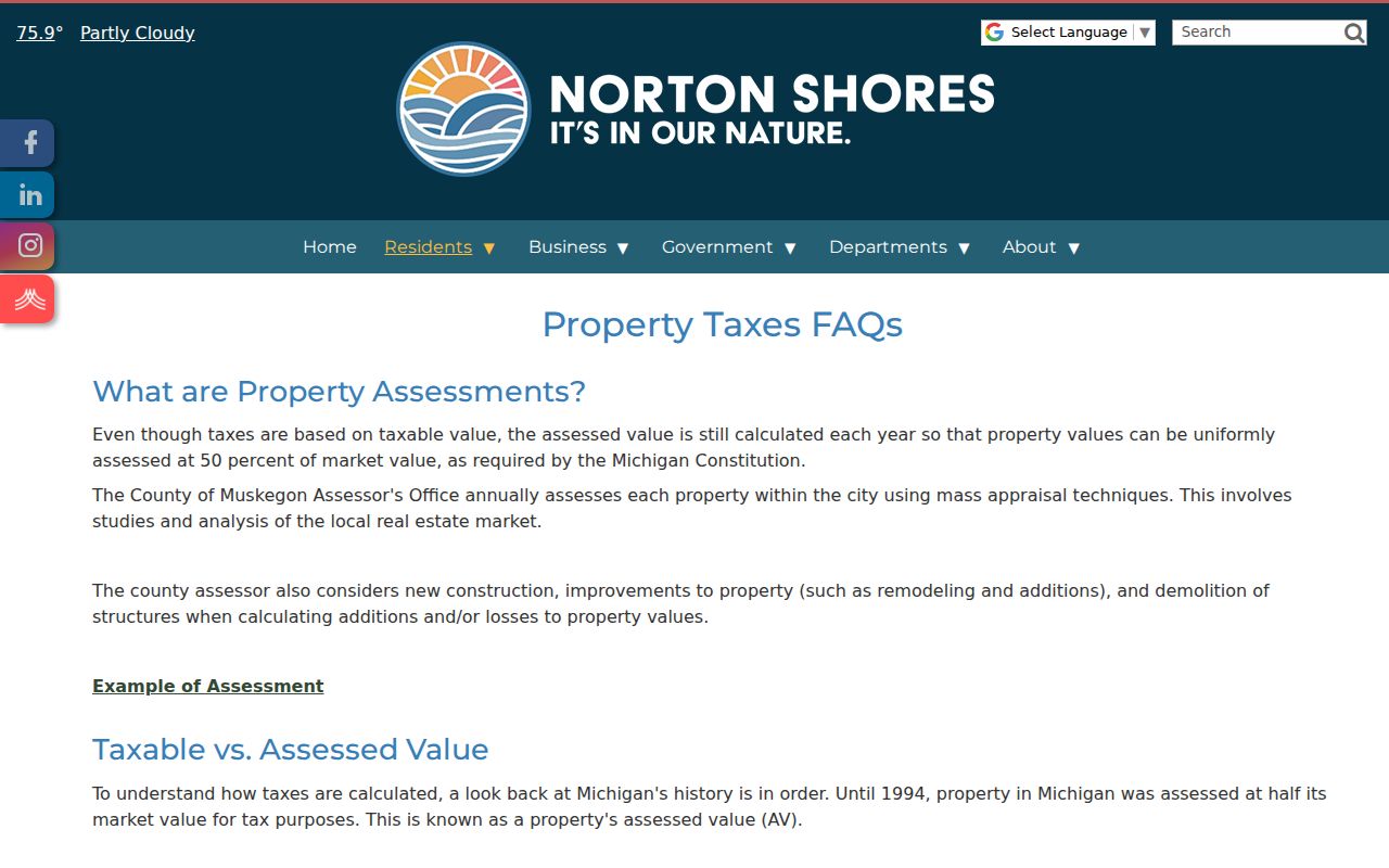
Keeping the tax route separate from the street directory keeps a payment record from being mistaken for a current-residency finding.
Norton Shores Street Directory Limits
No single Norton Shores street directory establishes every person connected to every address. A parcel can show ownership, a mailing field can show where notices go, and a historical directory can show a dated listing. Voter records are limited and protect selected information. Utility customer lists, driver information, and private association membership are not a street-browse layer. Use the source's actual role and date instead of filling a gap with inference.
For a historical address, compare a dated directory, a map or plat, and a verified parcel or deed description. For a current question, return to the official source and record the retrieval date. That approach respects both the limits of the records and the people connected to them.
Note: GIS adjacency means nearby geography only and must never be used to infer a private relationship between people.